
Future Land Use Map Designation Cut Sheet
| Map Color |  |
Sample Zoning | R-15, R-40, TN-R, TN-C, C-C, and L-O |
| Description |
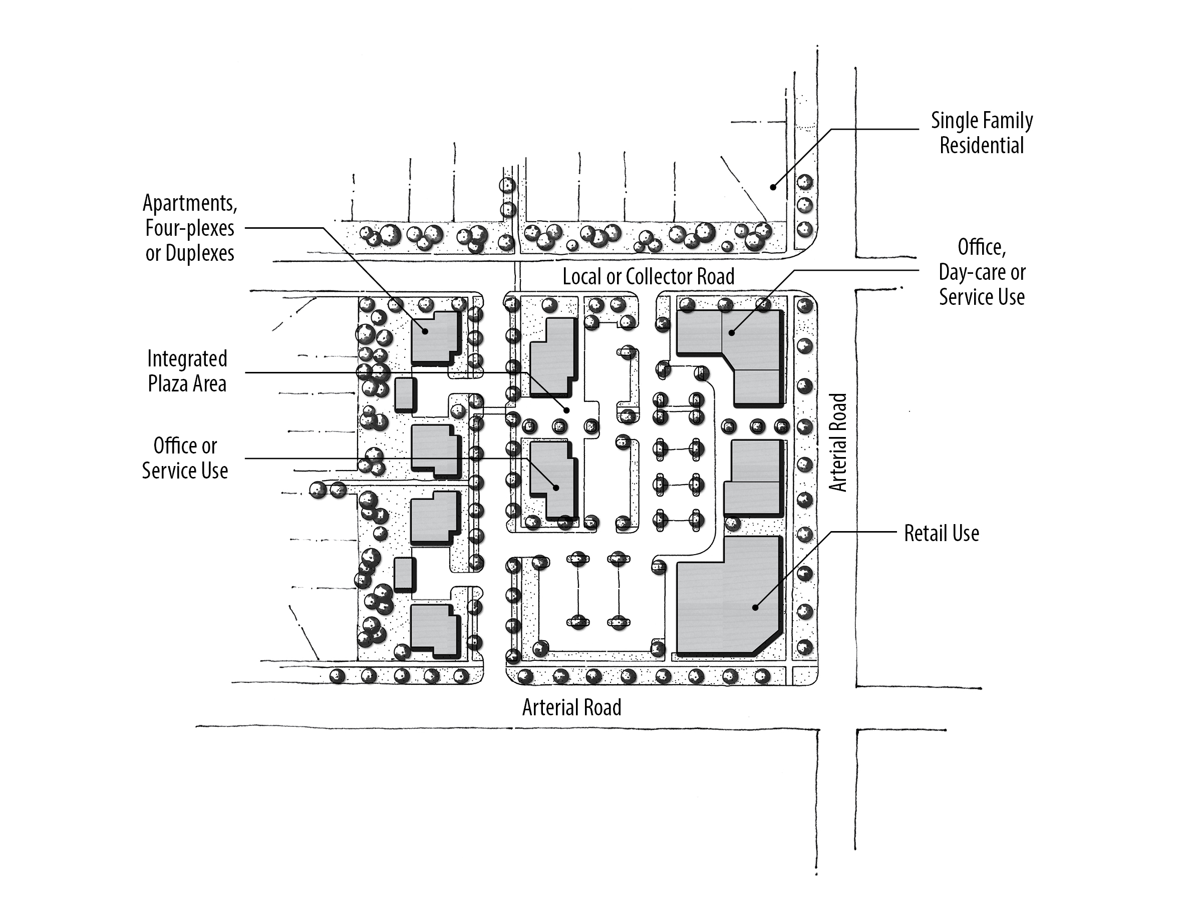
The purpose of this designation is to allocate areas where community-serving uses and dwellings are seamlessly integrated into the urban fabric. The intent is to integrate a variety of uses, including residential, and to avoid mainly single-use and strip commercial type buildings. Non-residential buildings in these areas have a tendency to be larger than in Mixed Use Neighborhood (MU-N) areas, but not as large as in Mixed Use Regional (MU-R) areas. Goods and services in these areas tend to be of the variety that people will mainly travel by car to, but also walk or bike to (up to three or four miles). Employment opportunities for those living in and around the neighborhood are encouraged. Developments are encouraged to be designed according to the conceptual MU-C plan depicted. |
| Sample Uses |
Sample uses appropriate in MU-C areas include: All MU-N categories, community grocer, clothing stores, garden centers, hardware stores, restaurants, banks, drive-thru facilities, auto service station, and retail shops, and other appropriate community-serving uses. |
Mixed Use Concept Diagram
| Design Direction |
|
Site Pattern
References & Resources
1. City of Meridian Comprehensive Plan
2. Meridian Unified Development Code
3. Meridian Architectural Standards Manual
Notes: See the References & Resources section for additional materials. When determining appropriate zoning of a property, the transition from existing, adjacent zoning designations, as well as future anticipated land use should be considered.
Questions?
Contact the Planning Division at 33 E Broadway Ave, Suite 102, Meridian ID 83642, or 208.884.5533, or https://meridiancity.org/planning/, or planning@meridiancity.org.
Last Modified: 04/01/20