
Future Land Use Map Designation Cut Sheet
| Map Color |  |
Sample Zoning | R-8, R-15, TN-R, TN-C, L-O, and C-N |
| Description |
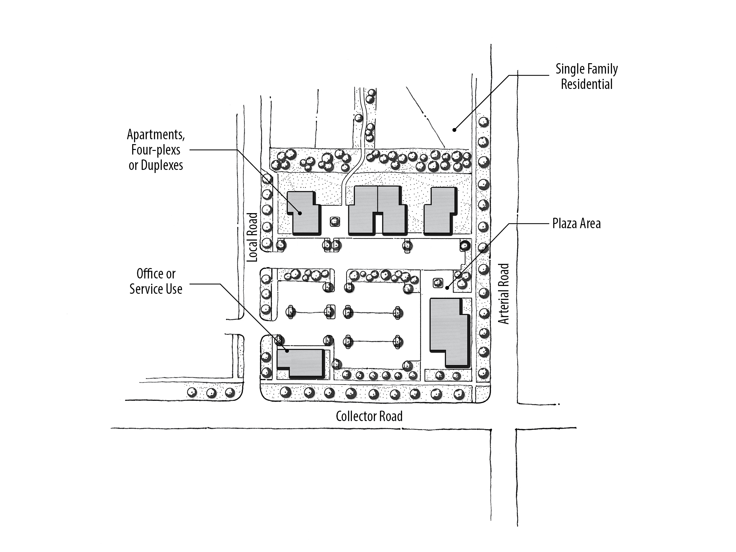
The purpose of this designation is to assign areas where neighborhood-serving uses and dwellings are seamlessly integrated into the urban fabric. The intent is to avoid predominantly single-use developments by incorporating a variety of uses. Land uses in these areas should be primarily residential with supporting non-residential services. Non-residential uses in these areas tend to be smaller scale and provide goods or services that people typically do not travel far for (approximately one mile) and need regularly. Employment opportunities for those living in the neighborhood are encouraged. Connectivity and access between the non-residential and residential land uses is particularly critical in MU-N areas. Tree-lined, narrow streets are encouraged. Developments are also encouraged to be designed according to the conceptual MU-N plan depicted. |
| Sample Uses |
Sample uses appropriate in MU-N areas include: alley-loaded single-family homes, townhouses, multi-family developments, neighborhood grocer, drug stores, coffee/sandwich/ice-cream shops, vertically integrated buildings, live-work spaces, dry cleaner/laundromat, salons/spas, daycares, neighborhood-scale professional offices, gift shops, schools, parks, churches, clubhouses, public uses, and other appropriate neighborhood-scale uses. |
Mixed Use Concept Diagram
| Design Direction |
|
Site Pattern

References & Resources
1. City of Meridian Comprehensive Plan
2. Meridian Unified Development Code
3. Meridian Architectural Standards Manual
Notes: See the References & Resources section for additional materials. When determining appropriate zoning of a property, the transition from existing, adjacent zoning designations, as well as future anticipated land use should be considered.
Questions?
Contact the Planning Division at 33 E Broadway Ave, Suite 102, Meridian ID 83642, or 208.884.5533, or https://meridiancity.org/planning/, or planning@meridiancity.org.
Last Modified: 04/01/20